Saturday, July 11, 2009

Burnt Ship Creek And The American Falls

Burnt Ship Creek is the wide marshy area that separates Grand Island from Buckhorn Island at the northwest corner of Grand Island, a short distance from the North Grand Island Bridges. I realize that Burnt Ship Creek could only have been formed by sliding icebergs as the glaciers melted and broke up at the end of the last ice age.

Image from Google Earth

The geometry of Burnt Ship Creek is completely wrong for it to have been carved by the river. The thing that is striking about Burnt Ship Creek is how symmetrical it's width is, at least until it widens in it's far western section. Another thing is it's abrupt right angle turn.

How can we see a marsh with near-symmetrical width and which makes an abrupt 90 degree turn and not think that something very unusual was at work here?

But suppose Burnt Ship Creek was carved by one or more sliding icebergs that broke free from the melting glacier and slid southward across the LaSalle section of Niagara Falls, NY. That would explain the existence of the creek perfectly. This explanation fits with what we see of the slope of the land caused by the underlying rock strata. The slope is to the south and west.

From Niagara Falls Blvd., it is fairly easy to see the downward slope of the ground going southward around 75th to 77th Sts. in Niagara Falls. Then, the upper rapids in the Niagara River just west of Grand Island is caused by the downward slope of the underlying rock strata going westward. 

The sliding icebergs, wearing away the ground beneath them as they moved, slid across what is now the Niagara River and then abruptly switched direction when the primarly slope of the underlying ground went from southward to westward. This explains the 90 degree angle of the marsh.

We can see the underlying slope of the ground at Burnt Ship Creek by the fact that it's western, downstream, end is much more watery than it's beginning. We can also see that the northern shore of nearby Navy Island forms almost a straight line with the southern shore of Burnt Ship Creek. This is because it was worn away by the iceberg as it continued westward. I can think of no better explanation of why this creek exists.

WHY ARE THERE TWO FALLS AT NIAGARA?

An enduring mystery of Niagara Falls is why does all the water not go over one falls. There is a definite tilt of the underlying rock strata in the area to the southwest. This is why water goes over the main falls at Niagara, the Horseshoe Falls. So why does about 8% of the water that is set to go over the falls make a northward detour, seemingly against gravity, to form a second falls at Niagara, the American Falls. Actually two other falls are formed by this detour, the other is the smaller Bridal Veil Falls.

A glacier brings a virtual ocean of water to areas high on land where this volume of water would not otherwise be and when the glacier melts, this water has a permanent effect on the land. In addition, if there is a slope to the land when a glacier melts, massive chunks of ice will break off and slide along the slope. This happened extensively at Niagara Falls.

There is a westward and southward slope to the underlying rock strata in the area of Niagara Falls, USA and so secondary glaciation in the form of sliding icebergs at the end of the ice age was a factor in forming the falls as we see them today. The upper river from North Tonawanda down to the falls is the lakebed of the former Lake Tonawanda that existed for most of the time since the end of the last ice age about 12,000 years ago.

The reason that this was the lakebed is that it is at the low line of a southward slope to the land in the area and itself has a westward slope toward the falls. We can tell by the Niagara Falls Moraine, the high ground on the Canadian side around the falls that it was impacted by massive blocks of ice sliding across the westward slope, seen in the Upper Rapids just before the falls.

The southward slope, best seen from Niagara Falls Blvd. looking southward along the numbered streets in the 70s in the LaSalle section of Niagara Falls is what deposited these icebergs from the melting glacier in the line that became the upper river after Lake Tonawanda drained.

Now, let's go back to Burnt Ship Creek. (Note-I am unsure where the name "Burnt Ship Creek" comes from. Presumably, in the days of wooden warships in the area, one ship fired hot shot into another).

I established that Burnt Ship Creek was formed by a massive iceberg that had slid down the southward slope in the 70s streets in LaSalle and then began sliding westward, toward what is now the falls, when it reached a point in which the slope was more westward than southward. This scraped away the ground along it's path and the result was Burnt Ship Creek, a wide marsh with a 90 degree angle, after Lake Tonawanda drained.

If the iceberg that formed Burnt Ship Creek had continued on it's course, it veers somewhat northward on it's westward course after it leaves the western end of Burnt Ship Creek, it will move along the course of the channel between Goat Island and the mainland that leads to the American Falls.

In some areas the general southwest slope of the underlying rock strata is more southward and in others, it is more westward. The route taken by this iceberg from Burnt Ship Creek to what is now the falls avoids the southward sloping areas so that the falls it caused to form results from a detour away from the main falls which seemingly defies gravity. The river was not there at the time, of course, so the iceberg continued westward to collide with the high ground on the Canadian side, where it finished melting.

The channel north of Goat Island leading to the American Falls has something in common with Burnt Ship Creek. Both get wider near their downstream, western ends. This can be explained by the fact that the iceberg that formed both was actually a mass of ice that was fragmenting and melting as it went along, eroding away the ground as it went, and thus spreading out. This formed a channel through which water later flowed from the main stretch of river and thus is why we have two falls, actually three, instead of just one.

Image from Google Earth

The sliding iceberg that formed Burnt Ship Creek continued westward to carve the channel through which water flows to the American Falls.

In a similar way, we could say that Goat Island (the land separating the two main falls) exists because the southward slope in the upper rapids, which is why the water above the falls is deeper on the Canadian side, kept such large chunks of ice moving westward away from it.

If we draw a straight line from the center of the wide marshy area through which Burnt Ship Creek flows at the point where it makes a 90 degree bend and continue the line, which represents the route of the sliding iceberg that formed both Burnt Ship Creek and the American Falls, as shown below:

Image from Google Earth

The line passes exactly along the center of the western part of the wide marshy area around Burnt Ship Creek, seen in close-up below. The highway crossing the creek is the I-190.


This shows that both Burnt Ship Creek and the American Falls were formed by a sliding iceberg, at the end of the last ice age, as described here. The small islands just above the American Falls are formed of the ground that was left intact as the iceberg broke up.

Secondary Glaciation And The Niagara Impact Craters

I would like to introduce a new branch of earth science that I have developed and which solves the puzzling landscape of the city of Niagara Falls, Canada. I have termed it "secondary glaciation", as opposed to primary glaciation.

SECONDARY GLACIATION

The effects of glaciers that is known already is primary glaciation. During an ice age, a glacier moving southward carves fearures in the land, such as the Finger Lakes of New York State. The glacier also carries large amounts of stone and dirt, which it leaves behind when it melts forming such glacial features as moraines, till and, kames. There are many textbooks on such primary glaciation.

In my work in natural history, I have featured glacial effects that I have never seen in any literature. These effects concern what happens when a glacier melts at the end of the ice age. Secondary glaciation involves three basic processes that have a lasting effect on the land.

First is the water from the melting glacier. During an ice age, a virtual ocean of water is transported to high ground where such an amount of water would not otherwise be. When the glacier melts, this vast amount of water flows back to lower ground and in doing so, has a great effect on the landscape that it crosses.

Second is glacial impact craters. As I have described in previous postings on this topic, when a glacier melts, it is warmer at the bottom of the glacier than at the top due to the simple fact that the air is warmer closer to the earth. This means that the bottom melts fastest and the glacier becomes top-heavy.

If the glacier is pressed up against a land mass, such as a large moraine or an escarpment, the ice is apt to fracture laterally so that a large slab of ice slides off the top and strikes the ground below. Such a slab may weigh millions of tons and may fall from a height of a kilometer or more so that it leaves a permanent valley or ridge in the ground below.

Third, is sliding glaciers. When the glacier melts and begins to break apart, a large piece of it may become lubricated by the water flowing beneath it and slide over slanted rock strata on which it lies. If it strikes any high ground in it's path, such as a moraine, it will leave a permanant indentation. Even if it does not, it will erode a path in the ground over which it moves which may later become a river or lake.

THE LANDSCAPE OF NIAGARA FALLS, CANADA

Now, let's take a look at the puzzling landscape of the city of Niagara Falls, Canada. This has nothing to do with the falls themselves, which are latecomers in the natural history and are easy to explain. If you would like a map connection go to http://www.maps.google.com/ and put in a search for "Niagara Falls".

In the southern tourist area of the city, you will notice that Stanley Ave. reaches a peak in elevation at it's intersection with Main St. Moving north along Main St., we see that it is actually a ridge that we are on as Allendale Ave. and Murray St. are much lower than Main St. where they intersect.

Google lists the street along the ridge as Main St. but it is also called Portage Rd. So, let's call this the "Portage Ridge".

Going northward on Main St., we can easily see that the streets get lower in each direction. Although it required going down a street such as Culp to see that we are on a low ridge. Main St./Portage Rd. reaches a high point at Lundy's Lane/Ferry St. and then decreases in elevation as we continue northward. If we turn westward on Lundy's Lane from Main St., we reach a peak, which is actually the highest point in the Niagara area just before the intersection with Drummond Rd. Let's call this "Mount Niagara".

If we continue westward on Lundy's Lane, it is easy to see by looking down side streets that we are on another ridge, which is much more well-defined than the Portage Ridge. This "Lundy's Lane Ridge" extends for quite some distance westward, at least to the power canal.

But this brings us to two puzzling mysteries. If you look at your map of the city, you can see Main St., which is built along the Portage Ridge, actually forms a semi-circle arc. If we continue the arc formed by Main St. on a map, it is easy to see that the arc formed by Valley Way from Stanley Ave. to Second Ave. is it's continuation so that we have essentially a 180 degree semi-circle formed. The difference is that the southwestern part of the arc, on which Main St. is built is a ridge, while the northeastern part of the arc, along which Valley Way is built, is a valley.

What on earth would cause an arc to form on the ground like this with half the arc a ridge and the other half a valley? Hasn't anyone been baffled by this other than me?

Now to the next mystery of Niagara Falls, Canada. Suppose one drives between two parallel roads in the city, Drummond Rd. and Dorchester Rd. Lundy's Lane and Thorold Stone Road are two parallel roads that run between Drummond and Dorchester Rds.

Lundy's Lane and Thorold Stone Rd. are only about 3 km apart. Yet the baffling thing is that on Lundy's Lane, you would start on a high point at Drummond Rd. and get lower as you went toward Dorchester Rd. While not far away, on Thorold Stone Rd., you would start low at Drummond Rd. and climb higher until reaching Dorchester Rd. How can we explain this?

The answer, of course, is the ridge upon which Lundy's Lane is built, even though both roads are built within the west side of the Niagara Valley, that we saw in the posting by that name on this blog. The ridge is so neat that it almost seems that it could be man-made. The usual slant to the ground is as it is on Thorold Stone Rd. This is actually the Niagara Valley that underlies the area of the falls. I discoveried this valley and described it in the posting on this blog by that name. The Lundy's Lane Ridge is what makes the elevation of Lundy's Lane between Drummond and Dorchester Rds. the opposite of Thorold Stone Rd.

What could possibly have formed the Lundy's Lane Ridge? These two mysteries are joined together. The Portage Ridge peaks where it meets the Lundy's Lane Ridge, forming "Mount Niagara" and does not continue south of this point. The other portion of the arc formed by the Portage Ridge, to the north of Lundy's Lane Ridge, actually forms the opposite of a ridge, a valley, namely Valley Way.

To answer these questions, let's first describe how this arc must have formed. On the American side, in the area of the falls, we see how the underlying strata of the rock slopes downward toward the falls. This slope also includes the upper rapids of the river just above the falls.

When the glacier began to melt, great masses of ice began to slide along this slope. This ice struck the Niagara Falls Moraine, the high ground on the Canadian side of tha falls and produced the indentation resulting in the bluffs above the falls, Queen Victoria Park and, Clifton Hill. We know that this must have been formed by some kind of impact because in other places, such as on Drummond Rd. and Ailanthus Ave. the high ground of the moraine lowers very gradually.

Another reason for believing that there must have been a great impact here is the "lip" formed at the top of the bluff. There is a significant drop in Dixon St. west of Stanley Ave. that would have had no reason to form if the bluffs above the falls were formed by another method, such as erosion by water. The Niagara Falls Moraine had earlier been deposited in the Niagara Valley.

On a map, it can be seen how glacial impact craters formed by great masses of ice sliding off this ice that had pressed up against the moraine around where the falls are now located and striking the ground with tremendous force. One such slab created the Portage Ridge and then another, from above where the upper rapids are now located, slid across the space where that slab had been and struck the earth, creating the Valley Way Crater.

These sliding glaciers reveal how the ridge upon which Lundy's Lane was formed. When the glacier began to melt and break apart, masses of ice slid down the west side of the Niagara Valley, around where Thorold Stone Rd. is now located. This vast amount of ice then began sliding southward, carving up the ground before it like a giant bulldozer.

As it got warmer, too much of the ice melted to push the load of ground any further and there it remains today. There is a dip in the road on Frederica St. just west of Drummond Rd. which shows where some of the meltwater flowed away.

This Lundy's Lane Ridge must have extended further east toward where the river is now. But then came the massive slabs of ice that formed the impact crater and the Portage Ridge. This slab of ice pushed back the dirt and stone forming the eastern portion of the Lundy's Lane Ridge and today it is piled up, creating the high point on Lundy's Lane just east of Drummond Rd. This is why Main St. reaches a peak at this intersection and gets lower in either direction.

Next comes another vast slab of ice, crossing over the area on the lower part of the glacier pressed up against the Niagara Falls Moraine and left vacant by the sliding of the first mass forming the first impact crater. This slab formed the Valley Way Impact Crater.

The reason that it formed a valley when the other had formed a ridge now becomes clear. The Valley Way area is to the north of the Lundy's Lane Ridge and so had already been "bulldozed" when this impact crater was formed. There was not enough loose dirt available to form a ridge and so, a valley was formed.

If the Portage Ridge was indeed formed by the impact of a vast slab of ice then, according to my hypothesis, is should have formed a culvert when the meltwaters of the slab would carve a channel in the ground while flowing away. Such a culvert in just the right place can be seen today in the wide dip on Fallsview Blvd. with a low point at Murray St. This culvert must have actually been the first falls at Niagara and flowed along what is now Murray St. just south of the Skylon Tower. There is no visible plunge pool at the bottom of the hill because it was flowing into the newly-forming Lake Tonawanda.

So that is my explanation of the landscape of Niagara Falls, Canada. The Lundy's Lane Ridge is much better defined that the Portage Ridge simply because it was fomed by a moving secondary glacier and not by an instantaneous impact crater. Lundy's Lane Ridge was formed by the same process as the bluffs above the falls and Queen Victoria Park and the similarity between the two can be readily seen.

This Lundy's Lane Ridge may be one of the best examples in the world of a "secondary glacial moraine". It could not possibly be a primary moraine because it would have been smoothed over by the primary glacier. Features created by secondary glaciation tend to be much more local than those created by primary glaciation. We can think of primary glaciation as a broad brush that paints over a surface and secondary glaciation as the finer brushes of artists that go back over the surface when the ice age ends.

DETAILS OF NIAGARA FALLS' TWO GLACIAL IMPACT CRATERS AND SUBSEQUENT WATER FLOW

A wide basin in which much of the city of Niagara Falls, Canada lies was formed around 12,000 years ago when the last glacier to cover the area was pressed up against the Niagara Falls Moraine, the high ground on the Canadian side by the falls. The glacier, a vast mountain of ice maybe a mile or more in height, fractured horizontally and a slab of ice weighing many millions of tons that had been the upper part of the glacier slid off and struck the ground with tremendous force.

The gradual side of the resulting impact crater closest to the glacier can easily be seen by driving westward on Kitchener Street from Victoria Ave. to Stanley Ave., which represents the bottom of the crater. If you keep driving westward on Kitchener St., you will climb the opposite side of the crater before reaching Portage Rd., roughly the edge of the crater.

The steep side of the crater can easily be seen today in the steep drop in Ferry St./Lundy's Lane just east of Sylvia Place, which is just east of Portage Rd. South of this drop was where the corner of the slab with the most force ended up as can be seen by the steep drops on Gray St. and Allendale St. perpendicular to the drop on Lundy's Lane/Ferry St.

The other impact crater that I have identified is not far from the first. From Victoria Ave. westward to Sixth Ave. there is a similar gradual slide from McRae St. downward to Valley Way and then a steep opposite side where the slab of ice came to a halt. The principle is similar to striking the soft ground with a golf club or sledge hammer at a low angle. The side of the resulting crater where the club hit the ground will be gradual and the opposite side, where it came to a halt, will be steep.

This crater could not have been carved by water flowing through what is now Valley Way because the two sides of the valley are so assymetrical, the north side of the valley is steep and the south side is gradual. It could not have been carved by a glacier coming from the north because it's steep side is to the north.

There is only a short section of the steep opposite side of the crater remaining today, the rest has been eroded away by water. The steep northern side of the "valley" section of Valley Way on both sides of Sixth Ave. eastward to Fifth Ave. is the section of the steep opposite side of the crater that is best preserved 12,000 years later. This corresponds to the steep drops in Lundy's Lane and Gray St. in the other crater.

However, I find that the erosion of the steep northern side of this crater from 5th Ave. westward reveals much about the natural history of the area since the crater was formed at the end of the last ice age. The larger impact crater, the one approximately bisected by Stanley Avenue, later filled with water, which we will call "Lake Niagara". This former lake that filled the crater after it had been formed, drained through the Valley Way Impact Crater, forming what we could call the "Valley Way River". It was this flowing water that eroded the steep northern bank of the crater that now forms the north side of the valley part of Valley Way from Sixth Ave. to Second Ave.

What happened is that the flowing water gradually eroded the northern side of Valley Way away. The side of the valley can still be clearly seen between Second and Fifth Avenues but is much lower than it is between Fifth and Sixth Avenues.

Another curious feature is that as one drives eastward along Valley Way toward Victoria Ave., the low level of Valley Way suddenly ends and Simcoe St. as well as the reminder of Valley Way as it curves toward the northeast is considerably higher in elevation. This makes it seem as if the former Valley Way River suddenly evaporated into thin air.

However, it is the heavily eroded northern bank of Valley Way from Fifth Ave. to Second Ave. that solves the mystery. Most of the water in the river overflowed the eroding bank and where Morrison St. meets Victoria Ave. today, there was once a pool of water that was filled by the former Valley Way River. The former eastern shore of the pool can be seen on Morrison St. looking eastward toward Buckley Ave. from Valley Way.

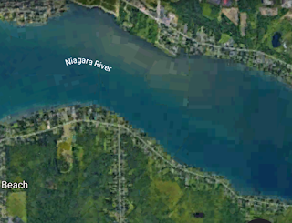
This pool was a temporary stop for the flowing water and it continued eastward toward what is now the Niagara River along the route now occupied by Park St., which has a noticably lower level that Queen St. or Bridge St., on either side of it. Since this pool was not big enough to call a lake, let's call it the Victoria Pool. It covered what is now the main crossroads where Victoria Ave., Morrison St. and, Valley Way meet.

Another curious fact that I observed in the area is that the northern side of the Valley Way valley actually makes a right angle turn. Around Second Ave., it turns northward and if we look westward on Morrison St. from Valley Way toward Second Ave., we see the rise in the road surface that corresponds to the bank.

The solution to this is fairly obvious. As the glaciers melted, there was a lot of water around. Especially when it rained heavily, water in torrents flowed down the gradual side of this crater toward what is now Valley Way. This added to the volume of water flowing through from the other crater.

This tremendous volume of water is more than the northern bank of the Valley Way valley could hold. The water flowed over the northern bank, eroding the bank until it looked like you see it today. So much water flowed over the bank and out of the river that the Valley Way River actually came to an end where Valley Way now meets Second Ave. and the much broader Victoria Pool took in the flowing waters.

The flow in the Victoria Pool was concentrated on it's western side. The entry of so much water down the gradual slope going up to Jepson and Mc Rae Streets flowing perpendicular to the Valley Way River created a vector flow. This vector flow caused the Valley Way River to turn toward the northeast toward the western end of the valley occupied by Park St. The reason for this pool forming here is that this area represents the low point between the general southward slope of the Niagara Escarpment and the northward slope, easily seen along Victoria Avenue, of the glacial impact crater which formed the "valley" of Valley Way.

This section of the flow caused the rise in Morrison St. seen looking west from Valley Way toward Second Ave. This flow was on the western side of the Victoria Pool. The eastern side of the pool, seen along Morrison St. looking east toward Buckley Ave., was much more stagnant.

This scenario leads us to another conclusion. That it was the erosion of the steep northern bank of the Valley Way Valley from Fifth Ave. to Second Ave. that caused Lake Niagara to drain of water, or was at least a part of the reason. This is similar in principle to the draining of Lake Tonawanda when the falls, eroding it's way northward, broke through the ridge at Hubbard's Point.

The other crater must have been full of water at one time, it is easy to see how flowing water has eroded what would have been the sharper edges of the crater if we drive along Portage Rd. going southward from Valley Way to Lundy's Lane.

Now, we come to another feature of the area. If you drive east on Mc Rae St. from Stanley Ave., you will notice a sudden drop and than the ground rises back up again. This slope is generally a part of the first crater's gradual slope down toward what is now Stanley Ave. But this valley here in McRae St. was carved by flowing water.

It could not have been carved while Lake Niagara was full of water, that would make no sense. But after the lake drained, the crater, about a square mile in area, still acted as a vast cistern to collect rainwater. This depression in McRae St. is the remains of a culvert or channel that drained rainwater and possibly meltwater from the glacial ice which formed the crater into the Valley Way River. The Valley Way River itself obviously served as a drain for the water that flowed down from the high ground upon which Lundy's Lane is now located and originated at some point to the west of the intersection of Valley Way and Portage Rd.

The area around where Jepson St. and Homewood Ave. meet Valley Way, including the lower area of Leslie Park, was a pooling area where waters gathered before flowing into the "valley" part of Valley Way. You can see two drops in street levels that define where the water was flowing faster in comparison with the relatively placid water in the rest of Lake Niagara.

The first, I have already pointed out in my other posting is on Stanley Ave. near McRae St. as one drives north toward Valley Way. The second is on Slater Ave. between Rosedale Dr. and Jepson St. While Lake Niagara was filled with water, these two drops were not shorelines but represented the division between the fast-flowing water in the Valley Way River area and the more placid waters in the rest of the lake.

The two gradual slopes that represent the slices into the ground by the slabs of ice that created the two impact craters intersect. The point at which the two meet is in what is today Leslie Park. If you walk along the sidewalk that leads across the park, starting where Slater Ave. ends at Jepson St. the sidewalk will first go past the pool.

At this point, you are walking across the gradual slope of the first crater, with the steep side at Lundy's lane as described above. When the sidewalk drops to a lower level, you are walking down part of the gradual slope of the second crater, the one with the steep side on the northern side of Valley Way, which you can clearly see from there.

In Leslie Park, notice how the slope used for sledding in the winter starts out very gradually and than gets dramatically steeper. The steep part is the result of later erosion by water but the gradually-sloping section is a part of the cut by the slab of ice.

If you were to go to the intersection of Sixth Ave. and Jepson St., if you look west on Jepson St., you are looking at the cut of the first crater, the one with the steep side at Lundy's Lane. The slope of Jepson St. is only as steep as it is because of later water erosion.

When you look in a perpendicular direction, north toward Valley Way, you would be looking at the gradual side of the other crater, the one with the steep side on the northern side of Valley Way. The crater with the steep side at Lundy's Lane was later to become Lake Niagara, the crater with the steep side at the north side of Valley Way was to become the Valley Way River which drained Lake Niagara.

Another thing that I noticed is that the gradual slope of both craters is divided into two sections. If you drive westward on Kitchener St. from Victoria Ave. toward Stanley Ave., you will notice that as you pass McDonald Ave., the slope gets noticably steeper. On the other crater it is not as noticable but along Jepson St., you may notice that the slope seems steeper to the north, toward Valley Way, than to the south, Toward McRae St.

The reason for this is simple. As the giant slab of ice weighing many millions of tons slid off the lower section of the glacier and cut into the earth, the cut is represented by the steeper part of the slope away from the glacier. The shallower part of the slope, closer to the glacier, represents an area in which the ground was not actually sliced away by the ice but was compressed when the slab of ice fell after it's front edge had struck the ground.

The tracks of the glacier as it slid across the underlying rock strata, which we know is tilted toward the southwest in this area at about 20 ft. per mile, can easily be seen on the American side. From the intersection of John B. Daly Blvd. and Rainbow Blvd. in Niagara Falls, NY, it is very easy to see the downward slope taken by the vast sheet of ice as it headed for it's collision with the Niagara Falls Moraine, the high ground on the Canadian side by the falls.

The slope that the glacier slid along can be very clearly seen around the intersection of Third and Main Streets in Niagara Falls, NY. If you wonder why the glacier was moving from east to west when glaciers usually move north to south, this slope explains it. As the glacier of the last ice age began to melt and break apart, large broken slabs slid across the underlying rock strata like this. This scenario also helps to explain why the embayment at Dufferin Islands, discussed in the posting on this blog by that name, survived this glacial era. It was out of the path of this glacier due to the nearby slope.

My belief as far as a timeframe for the formation of the craters is that the glacier pressed up against the Niagara Falls Moraine fractured horizontally but not evenly across. The fracture started lower on the north side of the glacier than on the south side. The vast slab of ice that created the crater at Valley Way, we will call it "The Valley Way Crater", extended southeastward over what is now Chippawa. It broke free by the force of gravity.

This weakened the structure of the glacier and the larger slab over what is now Niagara Falls, NY, that formed what we will call "The Lundy's Lane Crater" or "The Lake Niagara Crater", broke free and slid over the lower portion of the glacier that had been occupied by the other slab and struck the ground.

LAKE DORCHESTER AND THE VALLEY WAY RIVER
.
On Dorchester Rd, south of Thorold Stone Road,. we notice that the ground along side streets to the east gets higher, such as on Pettit Ave., Freeman St. and, Cherrygrove Rd. The ground gets lower on the side streets to the west but if we go into the lower ground, we see that at Apollo Ct. and at the end of Dirdene St., the ground gets higher again.

This is another former lake in Niagara Falls. Since it is bisected by Dorchester Rd., let's call it Lake Dorchester. At Dorchester Rd. near Morrison St., we see some higher ground but then it gets lower again going further south on Dorchester Rd. This shows us that Lake Dorchester was an elongated, possibly segmented lake along a north-south axis.

It conducted the water of the Valley Way River, which ended up at the intersection of Portage Rd. and Valley Way. The river changed it's direction from southward to eastward because it was blocked by the high ground of the Niagara Falls Moraine.

DRIVING TOUR OF LAKE NIAGARA GLACIAL IMPACT CRATER

In Niagara Falls, Canada, we can take a driving tour of the crater or indentation that I am describing. It will require no more than 20 mins. from the starting point.

Let's begin from the intersection of Portage Rd. and Arthur St. Go south on Portage Rd. toward Valley Way a block away. Notice how Valley Way is at the bottom of a small valley. This is where the Valley Way River that I described entered Lake Niagara.

Continue southward on Portage Rd. Look to your left (eastward) down Kitchener and North Sts. You can see that Portage Rd. is roughly on the former western shore of the lake. Stanley Ave., the main road that you see at some distance is at what was the bottom of the lake.

Turn left (east) at Lundy's Lane, the main road that you come to. A short distance down, just as you pass Sylvia Place, you undergo a steep drop. This is the side of the impact crater in the southwesterly direction in which the impact was focused. Right in front of the Lundy's Lane Historical Society, it is more historic than anyone seems to notice.

Continue three streets to Allendale Ave. and turn right. Go two blocks south and turn right on Robinson St. Before you turn, look down Allendale and see the steep drop the same as the one at Lundy's Lane.

Turn right (west) on Grey Ave., the next street, and go down the steep drop there.

These three drops represent the main focus of the impact, like the steep side of the indentation caused by a golf club hitting soft ground at a low angle. Notice that this is similar to the "valley" section of Valley Way, which represents the Valley Way Crater. These three drops, in the same way, represent the Lundy's Lane Crater.

Drive to Ferry St./Lundy's Lane, the main road. Turn right and then turn left on Stanley Ave, another main street that approximately bisects the former lake.

Driving north on Stanley Ave., look to your right on Kitchener St. and notice that this side of the former lake is much more gradual than the other side that you saw. That is because the impact came from this direction, and the side away from the direction of the impact ice tends to be steeper. The analogy that I like to use is that of a golf club striking soft ground at a low angle.

As you pass Stamford and McRae Sts., going toward Valley Way on Stanley Ave., you will notice a drop in the road. This was created by the former fast flow of water in the Valley Way River. North of this drop represents the fast flowing water from one side of the lake to the other. South of it represents the relatively placid water of most of the lake. North of Valley Way on Stanley Ave., it is clear to see the shore of the former lake on Stanley Ave. at Morden St. and in the eastern portion of Arthur St.

Proof Of The Niagara Impact Craters

Today, we can see that the melting glaciers of Greenland, caused by global warming, are sliding into the sea. This ideally explains what happened at Niagara Falls at the end of the last ice age. The reason that the high ground on the Canadian side near the falls, the Niagara Falls Moraine, seems to be indented is that a large section of glacier broke loose in what is now Niagara Falls, NY, slid across the rock strata, which is decidedly tilted toward the southwest, and struck the moraine. This put a wide indentation in the moraine that we see today as the broad area of Queen Victoria Park. The bluff on which the Skylon is built is the moraine.

The focal point of the collision is, as described above, about where Table Rock House and the intersection of Fraser Hill with the Niagara Parkway are now. This mountainous slab of ice then fractured laterally and sent the massive slab hurtling to the ground that created the Niagara Impact Crater. We can best see the impact which resulted as the drop in elevation of Lundy's Lane, at Sylvia Place east of Portage Road/Main St.

In the section of Main St. from the Rainbow Bridge to Pine Ave. and beyond in Niagara Falls, NY, we can easily see how the ground is dramatically slanted toward where Prospect Park is now located. This formed a collection point for more ice sliding across the ground as the glaciers were melting. The breaking off of the slab of ice caused tremors that resulted in another massive slab breaking off and creating the Valley Way Impact Crater when it hit the ground.

The path that the main section of the glacier followed westward towards that impact can be seen in the valley that it forms on both sides of the casino in Niagara Falls, NY. Looking south on 4th St. towards Buffalo Ave is the south side of the valley. Looking northward along the numbered streets from 4th to 10th from Niagara St. shows the rise in elevation representing the northern side of the valley. This terrain displays the classic U-shape to the ground that a moving glacier leaves behind.

It can easily be seen how the downward slope of Niagara St. westward from Portage Rd. to the falls gave the sliding glacier it's speed which left such a great indentation when it impacted the Niagara Falls Moraine and caused the glacier to fracture laterally so that the slab broke off.

As proof of my hypothesis of the sliding glacier and the glacial impact crater, I would like to point out that the axes of the sliding glacier moving westward along what is now Niagara and Falls Sts. toward Prospect Park and the river forms a straight line with the focal point of the impact of the slab of ice that broke off the top of the glacier and formed the large glacial impact crater in Niagara Falls, Canada. The impact can be seen as the drop in elevation on Lundy's Lane, and it can be seen on a map how the site of the impact is in a straight line from the route of the sliding glacial ice on the U.S. side. The sliding berg of ice collided with, and indented, the Niagara Falls Moraine to create the broad terrace of Queen Victoria Park, and then the glacier later fractured laterally to form the Lundy's Lane Impact Crater.

The focal point of the impact is, as pointed out in this blog's posting on this subject, the sudden drop in the roads on Ferry St./Lundy's Lane at Sylvia Pl. in Niagara Falls, Canada. This drop is also seen on nearby Grey and Allendale Aves.

The principle is the same as striking soft ground with a golf club or sledge hammer at a low angle. The resulting crater will have a steep side opposite the direction of impact. The area of these sudden drops is in a direct straight line with the path of the sliding glacier across Niagara Falls, NY.

The Niagara Valley

The most important reason that Niagara Falls exists as it does today is, of course, the escarpment. The water in the vast upper Great Lakes watershed will inevitably find it's way to Lake Ontario and at some point must fall over the escarpment.

THE NIAGARA VALLEY

I have found what must be the next most important factor in the formation of Niagara Falls after the escarpment. I have named it the Niagara Valley. It is a wide valley in the underlying rock layers aligned roughly north-south. This valley is very old and is not easily visible today since it has been largely filled in by the Niagara Falls Moraine, the high ground on the Canadian side by the falls, and carved up by the Niagara River.

But this valley was the underlying factor in all that happened at Niagara Falls. This posting may actually be considered as the most important one about Niagara natural history because all of the other Niagara postings are about the effects of flowing water and moving glacial ice, but this one is about the underlying geology which shapes all else.

Here is the map link that I usually use. The straight-line section of the Lower Niagara River from the ninety degree angle at the falls north northeastward to where Bridge Street on the Canadian side and the Whirlpool Bridge is located runs along the low line of the Niagara Valley, which extends westward into Canada and eastward into the U.S.: www.maps.google.com .

The place that this old valley is most visible today is on Thorold Stone Rd. in Niagara Falls, Canada. If you go eastward, toward the river, on that road from the intersection with Dorchester Rd., you will reach a high point and then begin a long and gradual drop that reaches all the way down to the present Niagara Gorge. This is the western side of the valley.

A few miles to the southeast, on the American side, anywhere near the falls the southwestward slope of the rock strata is unmistakable. From the intersection of John B. Daly Blvd. and Rainbow Blvd., if you look westward along Rainbow Blvd. toward the falls, you will see another long and gradual drop, this time in the opposite direction. This is the eastern side of the valley. This valley was not carved by water at all but is along the underlying rock strata.

Another glimpse of the western side of the valley can be seen in the way that Lundy's Lane climbs higher west of the intersection with Portage Rd. in Niagara Falls, Canada. Although here, the valley has been covered by the Niagara Falls Moraine, which was deposited by a later glacier.

The upper rapids above the falls begin at the eastern edge of the slope of the Niagara Valley in the Niagara River. We know that these rapids are created by the same slope in the underlying rock that we see along Rainbow Blvd.

A large amount of soil and loose rock was deposited in the valley by an ice age glacier. This is what we now refer to as the Niagara Falls Moraine, and is seen as the high ground on the Canadian side of the falls, including the slope of Clifton Hill. The eastward part of the moraine was pushed in to it's present position by the falls by sliding fragments of the last glacier as it melted and broke apart. This moraine, and the Niagara River that made a northward turn when it collided with it, are the reasons that the valley is so difficult to discern today.

FORMATION OF THE NIAGARA VALLEY

To understand how the Niagara Valley, and thus the falls as they are today, formed we must look at the big picture of North America. The Appalachian system of mountains in the eastern USA was formed by the collision between what is now Africa and what is now North America, as described in the posting on the geology blog "All About The Appalachians". This long system includes the Allegheny, Blue Ridge, Catskill, Adirondack, Green and, White Mountains. It also includes the system of ridges in Tennessee and Kentucky that parallels it.

The Appalachians are much older than the Rockies in the western part of the continent so the collision that formed them happened long before the collision of the entire western hemisphere with the Pacific Plate. The collision that formed the Appalachians also forced up layers of rock strata adjacent to the mountains such as the Allegheny Plateau in New York and Pennsylvania.

Now, back to Niagara Falls and the underlying Niagara Valley. This valley includes the slant in the underlying rock strata to the southwest above the falls at about 20 feet (6 meters) per mile (1.5 km). This is what gives us the upper rapids and is why the water above the falls is deeper on the Canadian side.

The underlying Niagara Valley is most obvious here in it's contrast with the opposite slope of Thorold Stone Road. The southward element of the slope in the underlying rock above the falls is not a part of the Niagara Valley. The southward slope is a property of the escarpment itself and is visible in the numbered streets in the LaSalle section of Niagara Falls if we look south from Niagara Falls Blvd. along the 70s numbered streets. This direct southward slope, with no westward slope element, means that the 70s streets, in Niagara Falls NY, are located eastward beyond the Niagara Valley.

The fracturing of the rock strata, as the pressure of the Appalachian collision met the Niagara Escarpment, was not perfectly neat. The resulting southwestward  slope, the southward element of the slope is the result of the sawtooth shape of the escarpment and the westward element is the result of the Niagara Valley, is greatest near the falls, on the American side. But lesser westward slopes, the result of the Appalachian collision forming the Niagara Valley, can be seen well to the east in the landscape of Niagara Falls, NY.

There is actually a subtle boundary region where the primary underlying slope becomes southwestward instead of southward. If we look east on John Ave. from 66th St., we can see in the surface of the street the beginning of the westward slope that extends down to the falls. The subtle westward slope can also be seen in the parking lot of Home Depot on Builder's Way. The westward slope of Girard Avenue, between the Interstate 190 and 56th Street, is just barely perceptible. Closer in the direction of the falls, if we look westward along Pine Avenue from Hyde Park Boulevard, the westward slope becomes somewhat more perceptible. On Main Street, near the area of the falls, the westward slope of the Niagara Valley is very definite. Further north, the westward slope of Ontario Avenue is another place where we see the Niagara Valley.

The point of this is that this section of the lower Niagara River, below the falls, is aligned from south southwest to north northeast along exactly the same angle as are the Appalachian Mountains and ridges before the great curve of the collision front across Pennsylvania. Remember that this section of the river flows along the low line of the Niagara Valley. This can be easily seen if we look at a map of eastern North America alongside a map of Niagara Falls.

Thus, it is my conclusion that the continental collision which resulted in the Appalachian Mountains exerted tremendous force that caused a fracture in the rock strata at a distance and resulted in the formation of the Niagara Valley.

The Niagara Escarpment broke in two places , one on each side of it. The most clear break is the one on the side of the escarpment away from the collision front, at Short Hills Provincial Park near St. Catharines. On the opposite side of the escarpment is the break which forms the Niagara Valley. This break caused a shift in the terrain at right angles to the break at the Niagara Valley, which is why the Upper Niagara River shore of the city of Niagara Falls, NY forms a continuous line with the axis of the Decew Lakes near St. Catharines and the "breaking point" of the escarpment on it's opposite side. This is also why the Upper and Lower Niagara Rivers, above and below the falls, seems to form a perfect right angle. This should not seem unusual at all as the Niagara Region is really not far from the Allegheny Plateau that was created by the collision.

The river from the Horseshoe Falls to the Whirlpool Bridge represents the low point of the Niagara Valley. Water always seeks the lowest point and this is why this stretch of the lower river follows the course it does today. To get to the falls, water in the upper rapids is flowing down the east side of the Niagara Valley. Once the river passes the Whirlpool Bridge, it is past the end of the valley and it's course diverges.

THE HUMBER LINE AND THE NIAGARA VALLEY

Let's now turn to the place where the straight line section of the lower Niagara River curves to the west, along what is known as the Lower Niagara Rapids, toward the whirlpool in the Niagara River.

Remember in "All About The Appalachians", we saw how the geographical features created by this tectonic collision revolve around what I defined as the Humber Line, named for the valley across Toronto where it is most visible. The Humber Line is the line that I noticed extends from the "focal point" of the curve of the Appalachians, around the city of Harrisburg in Pennsylvania, through the long axis of the elongated Georgian Bay in Ontario. In the opposite direction from Harrisburg the Susquehanna River, which meanders around northeastern Pennsylvania before reaching Harrisburg, suddenly adheres to a straight line flow along the Humber Line after passing Harrisburg.

If we follow the line of the Humber Line through the general area of the Niagara River, we see that it forms the straight line of the easternmost shore of Lake Erie, from Blasdell to downtown Buffalo. We then see that the Humber Line forms the straight line of the southwestern shore of Navy Island, the uninhabited Canadian island in the upper Niagara River. Notice that this shoreline is a perfect continuation of the easternmost shore of Lake Erie.

We then see that the Humber Line intersects the Niagara Valley. In fact, the Niagara Valley ends at the Humber Line, where the lower Niagara River ceases to be a straight line and curves along the lower rapids. The Humber Line then appears along the northern shore of Lake Ontario at Humber Bay, in Toronto. The well-known drop in elevation along east-west streets to the west of downtown Toronto, such as Bloor Street, represents how the land is elevated on the east side of the Humber Line due to the difference in pressure as the collision front of the Appalachians shifted direction across Pennsylvania.

(Note-I don't want to digress too much here, but the reason that this shift caused by the change in direction of the Appalachian collision front is so well-defined along this line is that the Humber Line was actually once a longitudinal line of magma emergence when the north pole was migrating across Canada, from it's former position at what is now the Great Basin of the western U.S. to it's present position, as described in "The Story of Planet Earth" on the geology blog).

The reason that the Niagara Valley ends at the Humber Line, at the beginning of the Lower Rapids, is that the break in the structure of the Niagara Escarpment which formed the Niagara Valley only took place to the west of the Humber Line. To the west of the Humber Line, the pressure on the land from the south increased as the collision front of the Appalachians changed direction as it continued eastward. To the east of the Humber Line, the force was enough to simply shift the Niagara Escarpment to the north.

This meant that there were fewer special effects on the land, such as this Niagara Valley, than there were to the east of the Humber Line. To the west of the Humber Line, there was not quite enough force to shift the entire escarpment so the force went into creating various special effects. The shifting of the escarpment itself created a special effect, that can easily be seen on a map, as the smooth bulge of land extending out into Lake Ontario between the cities of St. Catharines and Rochester, as we saw in the posting "The Niagara Escarpment Bulge And The Appalachian Collision".

Another such "special effect" of the pressure against the Niagara Escarpment west of the Humber Line is the rocky ridge which extends to the west of the town of Fonthill, Ontario, and which was described in "All About The Appalachians" on the geology blog, in the section "The Appalachian Collision And The Niagara Escarpment". Just as the Niagara Valley only continues until it meets the Humber Line, this rocky ridge only continues eastward until it meets the "breaking point" of the escarpment, which is at Short Hills Provincial Park, near St. Catharines. The Break in the escarpment, caused by building pressure along the Appalachian collision front to the south, should logically have taken place right at the Humber Line. The reason that it didn't is that the rock strata has a structure of it's own and is not "fluid". So, the break in the escarpment took place just west of the Humber Line, at Short Hills.

There have been two rivers across the Niagara area, from Lake Erie to Ontario, the present Niagara River and the St. David's River in the warm period before the last ice age. The St. David's River flowed from what is now Dufferin Islands, on the Canadian shore of the Niagara River, across what is now Goat Island. The sections that are common to both rivers are the lower rapids and the whirlpool.

The St. David's River flowed through what is now the whirlpool and met the escarpment at the Ontario village of St. David's, hence it's name. Along the QEW Highway (Queen Elizabeth Way), west of Stanley Avenue, there is a wide area of a lower elevation adjacent to the village of St. David's which is a remnant of this former river before it was mostly filled in by soil and loose rock carried along by the glaciers of the last ice age.

But notice that this St. David's River followed the Humber Line exactly from the point where it encountered the line in what is now downtown Niagara Falls, NY. The St. David's River route from the whirlpool at the village of St. David's is right along the Humber Line. The St. David's River followed the Humber Line, the lower Niagara River follows the Niagara Valley which ends at the Humber Line. The whirlpool formed when the Niagara River's flow and falls excavated the loose fill of the former St. David's River, and this directed the Niagara River in another direction so that it does not follow the course of the Humber Line.

RIDGES WITHIN THE NIAGARA VALLEY

One other notable feature of the area is the so-called Lyell-Johnson Ridge. This is a low, rounded ridge that cuts directly across the valley. When the falls, eroding it's way southward, about 3,500 years ago cut through the high ground at Hubbard's Point, Lake Tonawanda began to drain and Niagara Falls as we know it began to take shape.

This ridge is visible along River Rd. in Niagara Falls, Canada extending south from the Whirlpool Bridge with the high point at Eastwood Cr. It is also visible on the American side on Whirlpool St., as you pass Spruce and Cedar Aves.

Another such ridge can be seen in Niagara Falls, Canada on Stanley Ave. If you head south from Bridge St., you will go over the same type of low and rounded ridge.

These two ridges are part of the rock structure, and are not glacial in origin. They can in no way be explained in terms of the Niagara River. But, if we consider the Humber Line, it is easy to see that both ridges are immediately west of it and, like the Niagara Valley which they are within, terminate before the Humber Line. There are no such ridges to the east of the Humber Line. These two ridges are explained as a part of this scenario with the Appalachian collision. They are reeves in the rock strata that were formed by the same pressures as the Niagara Valley, and are congruent to the rocky ridge west of Fonthill.

(Note-this Lyell-Johnson Ridge also helps explain why the embayment at Dufferin Islands, that I have discussed in other Niagara postings such as "Dufferin Islands And The Former St. David's River", is where it is. The embayment is a former whirlpool from the previous warm inter-glacial period. It is located as far west as it can be due to the underlying slope of the rock strata along the eastern side of the Niagara Valley but it could not be any further west or else it would be too low for water from it to be able to cross the Lyell-Johnson Ridge on it's way northward to the escarpment).

One other such ridge, which is within the Niagara Valley and formed by the same pressure from the Appalachian collision as it, is what some natural historians refer to as "Niagara Island". This is not an actual island but is an area of a little higher elevation in the rock strata right downtown in Niagara Falls, NY near the falls. The large hotel with a curved front brick facade, John's Hotel Niagara, is built on this elevation. The reason for referring to it as an island is that it was briefly an island when the former Lake Tonawanda drained after the falls, cutting it's way backward to it's present location, cut through the Lyell-Johnson Ridge about 3500 years ago.

The Unique Islands In The Upper Niagara River

There are seven major islands in the upper Niagara River above the falls: Grand Island, Beaver Island, Buckhorn Island, Navy Island, Cayuga Island, Squaw Island and, Tonawanda Island. I have identified the processes by which these islands were created and cannot find any reference to any of it anywhere else.

The Niagara River is unusual in that it flows from one lake to another rather than collecting tributaries to drain a watershed. This may mean that islands of these types may be unique or at least very rare in the world. This scenario does not involve Goat Island, which is at the falls.

SPLIT ISLANDS

There is something really mysterious on the Niagara Frontier that seems to defy explanation. It is much more unique than the falls. Yet, I have never read or heard that there is anyone who puzzles over it except me. This very unusual phenomenon is some distance from the falls and so does not get attention lavished on it.

Has anyone ever wondered why the Niagara River suddenly and inexplicably splits into two sections which then come back together again, creating Grand Island? Grand Island is flat, so high ground is not a factor. I find this to be very puzzling and I can find no documentation on it or even any evidence that anyone else seems to have wondered about it. Most of the attention to the Niagara River goes to the falls and gorge while the upper river is ignored.

The Niagara River is divided roughly in half by the falls into upper and lower sections. A map of the area will make this posting much easier to understand. 

Image from Google Earth

Why would a sizable and fast-flowing river suddenly split into two approximately equal channels? If you look at the southern tip of Grand Island, Beaver Island State Park, or the opposite shores in Tonawanda, NY and Ontario, there is not the slightest sign of anything that could cause such a split.

The Niagara River does make an abrupt right angle turn where the falls are now but that is due to the high ground on the Canadian side, the Niagara Falls Moraine. The ground on all three shores, and throughout all of Grand Island, is at about the same level. There is a hill on Grand Island, behind the library, but it looks too symmetrical to be natural. The island is divided approximately in half by the I-190 that crosses it.

Where else in the world do you see a large river split in two for no obvious reason? This is far more unique than the falls. The nature of planet earth dictates that streams combine to form rivers. But rivers do not split into smaller rivers. These islands are not sedimentary in nature and cannot be explained in the same way as a river delta. High ground is not a factor.

My explanation for this phenomenon lies in the former Lake Tonawanda that once covered the area. To understand the upper Niagara River, we must understand that it was part of a lake from about twelve thousand years ago until maybe three thousand years ago. This former lake took in water overflowing from Lake Erie and could be considered as a minor lake of the Great Lakes like Lake St. Clair. What is now Grand Island was once covered by the southern part of this shallow lake.

As this lake began to drain because of the slicing of the falls through the ridge at Hubbard's Point about 3,500 years ago, the water level began to drop while about the same amount of water continued to enter the lake from Lake Erie through the southern part of the Niagara River, which was not covered by Lake Tonawanda.

Hubbard's Point is the peak of the ridge that the falls sliced through while eroding it's way southward, from it's origin at the Niagara Escarpment after the end of the last ice age, to the present position of the falls. The peak of what is called the Lyell-Johnson Ridge is visible north of the Rainbow Bridge approximately adjacent to the aquarium on the U.S. side of the river.

The yellow line, across the Lower Niagara River near the top of the following image, is the high point in the rock strata some distance north of the Rainbow Bridge. After the falls, cutting it's way southward, cut through this high point, about 3,500 years ago, Lake Tonawanda began to drain. The present position of the falls can be seen at the bottom of the image.

Image from Google Earth

As the southern shoreline of Lake Tonawanda retreated northward, the situation of the river flowing into it from Lake Erie changed. The original route taken by the flow of water was no longer the most direct route for the water to get to where it was ultimately going, toward the falls.

We must understand that the flow of water from Lake Erie into the Niagara River is far from even. The flow can vary for several reasons. The level of water in Lake Erie due to storms and inflows affects how much flows into the Niagara River. Ice can jam the entrance to the river and when the jam melts enough to break up, a surge of water into the river results. When the wind is blowing across Lake Erie from the southwest, it pushes water toward the Niagara River, when it is from the northeast, it pushes water in the lake away from the Niagara River.

This surge factor is increased by the fact that Lake Erie is shallow for such a large lake. It's average depth is about 62 feet, compared with Lake Ontario at over 280 ft. Water, as you know, obeys the laws of physics and seeks the lowest ground and the path of least resistance.

As the shore of Lake Tonawanda retreated northward, some of the excess water from surges found a more direct route toward the falls. This new flow of water eroded the ground, which made the route easier for the water from the next surge to find. Eventually, this process caused the river to split into two roughly equal halves. These two channels of the Niagara River found their way to the same shrinking Lake Tonawanda.

But the lake was draining to the point where it was only about a mile (1.5 km) wide. This happened by about two thousand years ago. Since the water was still flowing into such a diminished lake, and the lake was draining into a lower river and going over the falls, the lake became, in effect, a broad river. It remains today as the upper Niagara River from North Tonawanda downstream to the falls.

This is why the river seems to split in two and then come back together again. The result of the draining of Lake Tonawanda, beginning about 3,500 years ago, combined with the surges of water from Lake Erie into the Niagara River, is a phenomenon that, as far as I can tell, is repeated nowhere else in the world.

The Niagara River appears to split in two for no obvious reason and the two channels later come back together again. The land in the middle is what we know as Grand Island. This is far more unique in the world than the falls or the gorge.

Image from Google Earth

The Niagara River flows from south (bottom) to north. The river split from the older Tonawanda Channel (right) to the newer Chippawa Channel (left). The mass of land between the two channels is known as Grand Island. The Tonawanda Channel is between Grand Island and Tonawanda. The Chippawa Channel is between Grand Island and Canada. The present remainder of what was once Lake Tonawanda is the broad Upper Niagara River, immediately north of Grand Island.


Here then, is a definition of what I am going to coin "The Split Process": A flow of water goes by the most direct route it can find into the body of water into which it drains. But if the shoreline recedes and the flow must lengthen, the flow direction of the incoming water may no longer be the most direct route.

The direction of the incoming water and the erosion of the channel will maintain the original route while some of the water, particularly during times of incoming surges or increases in flow, may find a more direct route toward the new shoreline of the destination body of water. This will cause the river to split into two parts. This is what formed Grand Island, which we will describe as a "split island".

We should remember that, as a target shoreline recedes which is what happened as Lake Tonawanda drained, it may not be necessary for a new flow to start to find the most direct route if the original flow is still close to the most direct possible route to the new shoreline of the destination body of water. It also may not be necessary for a surge to commence the new flow.

The split of the Niagara River into the Tonawanda Channel between Grand Island and the Tonawandas and the Chippawa Channel between Grand Island and the Ontario shore must have occurred fairly close to the southern limit of the former Lake Tonawanda.

Today, the Tonawanda Channel represents the original flow line while the Chippawa Channel represents the new flow line. The Chippawa Channel is a much more direct route to where the water is going.

The apparently illogical Tonawanda Channel, which winds far away from the most direct water route to the falls, is a relic of the former Lake Tonawanda. As this channel passes North Tonawanda, it gets considerably wider. This is another relic of Lake Tonawanda. The Niagara River would look much more logical if the entire Tonawanda Channel from Beaver Island State Park, at the southern tip of Grand Island, all the way to Buckhorn Island State Park, on the northwestern tip of Grand Island, did not exist and all of the water flowed through the Chippawa Channel.

The southern portion of the Chippawa Channel varies considerably in width, from wide to narrow and back again. This leads me to believe that large ponds, represented by the wide areas, in low areas just after the retreat of Lake Tonawanda may have served as steps in the formation of the Chippawa Channel. The water from Lake Erie surges could have found it's way from one such pond to another in it's search for a quicker way to it's destination.

The first possible pond is near the beginning of the channel, opposite Beaver Island, we will call this "The South Pond". The second is further upstream, opposite Douglastown, we will call this "The North Pond". From there, the new flow would have enough momentum so that no more ponds would be needed as stepping stones.

As time went on and the southern shore of Lake Tonawanda retreated still further, this split process repeated itself in the new Chippawa Channel. This channel split in two for the same reason as the river did earlier. The origional flow of the water continued because that was where the channel had been eroded from the ground but surges caused a split so that a new and more direct arm of the Chippawa Channel could establish itself.

The land between the channels is what we call Navy Island. This island is a miniature of Grand Island. Such an island never formed in the Tonawanda Channel because there was no really practical more direct route.

Image from Google Earth

Looking at Grand Island and Navy Island today, we can see evidence of what I will coin "The Sixty Percent Rule" or "The Three Fifths Rule". When the split process occurs, about three fifths of the water flow will go through the new channel and the rest through the origional channel. This seems to be the case with both split islands.

SURGE ISLANDS

Now that we understand split islands, let's meet a new kind of island in the Niagara River created by a process that I have identified, "surge islands". There is one obvious example of this type of Island in the upper Niagara River. It is carved out of the southern tip of Grand Island and is known as Beaver Island.

Surge islands in the upper Niagara River are related to split islands in that their formation is made possible by surges of water from Lake Erie. The difference is that in a surge island, spillover water finds it's way back into the river from where it came, instead of to the destination body of water, and by eroding the ground in doing so, creates an island.

Image from Google Earth

Surge islands are always carved out from the mainland and are never found in mid-channel, unlike split islands. Two defining features of a surge island is that their riverward shoreline is a continuous line with the shoreline of the mainland from which they were carved and the angle between the flow of it's inlet and the main river cannot be too shallow or the water would simply be deflected by the land it was hitting instead of forming a surge island. I would say that surge islands are most likely to form when the surge line meets land at an angle of from 45 to 90 degrees.

Near the southern entrance to the Chippawa Channel, surges could wash over the land and then the water could find it's way back to the river, in the process eroding a route through the ground. This caused the surge island to be carved from the newly formed large split island, Grand Island. Beaver Island is a part of the New York State Park of that name.

You will notice on a map that Beaver Island is located directly in the main route that a surge from Lake Erie through the Chippawa Channel would take. We will call this route the "surge line".

The yellow line in the following image, from southeast to northwest, is the surge line, which is the main thrust of the surge, that formed Beaver Island.

Image from Google Earth

Notice in the satellite images that the beach at Beaver Island State Park, which is not actually on Beaver Island, is almost exactly the same size and shape as Beaver Island itself and seems to have been a sibling surge island that was eroded away by the force of the surges, forming the inlet of the beach. The line across the image is the international border.

Image from Google Earth

(Note-By the way sand is formed by rock being gradually broken down by the action of waves. It takes a very long time to form and only forms on seacoasts. Sand does not form on rivers or lakes. If there is sand on a river or lake beach you can be sure that it was brought in by truck).

VECTOR ISLANDS

Going northward from the southern tip of Grand Island, the Tonawanda Channel forms a semi-circle and then makes a sharp turn to the north. this turn northward, I believe, is where we could say that the Tonawanda Channel proper meets the remains of Lake Tonawanda.

At this point, the channel looks on a map like a powerful hose pointing at the adjacent land. It seems to be an ideal place for a surge island. Yet, the island that would form would be a more complex type of surge island than Beaver Island because of another factor at work.

Image from Google Earth

Notice how the curve of the Tonawanda Channel points directly at what would become Tonawanda Island (upper right).


After the retreat of Lake Tonawanda a flow of water, Tonawanda Creek which is joined by Ellicott Creek, had formed and emptied into the newly-formed Tonawanda Channel very near the surge line of the channel. The creek would be a factor in the island that would form. Remember that, after the end of the last ice age, there would be many times the volume of water flowing through the creek that there is now.

Spillover water from surges swept over the land in the direction that the river was flowing. This surge water met the water flowing toward the channel from what would become Tonawanda Creek. The two colliding flows of water formed a flow in a vector direction as the lake retreated, which is why Tonawanda Creek curves sharply northward, in the direction of the current, as it nears the river.

At the time, the flow that was to become the creek was new and it's channel was not fully established in the ground because the lake shoreline had only recently retreated and so was open to a change in direction to form the vector. Later spillover from surges in the Tonawanda Channel eroded it's way to this curve in Tonawanda Creek.

Image from Google Earth

Tonawanda Island is shown. Notice how Tonawanda Creek, at bottom, makes a sharp northward turn, due to the surge I am describing, before emptying into the Tonawanda Channel of the Niagara River. The edge of Grand Island is visible to the far left. Tonawanda Creek was later dredged and widened and used as a section of the Erie Canal.


The resulting island is more complex than a simple surge island because the creek is a major factor in it's formation. Tonawanda Island is what we will call a "vector island" because the spillover along the surge line meets another flow of water, the creek, and the two join in a vector direction, eroding it's way into the ground and forming an island by cutting it off from the mainland. As with the other surge islands, we can see on a map that the riverward shoreline of Tonawanda Island forms a roughly contiguous line with the shore of the land from which it is carved.

Has anyone besides me ever noticed the similarities between Tonawanda Island, Unity Island in Buffalo and, Cayuga Island in Niagara Falls? In usage, the three could scarcely be more different. Tonawanda and Squaw Islands are industrial while Cayuga Island is a quiet residential neighborhood.

All three are in ideal places for surge islands, with the surge line of the Tonawanda Channel pointing directly at Tonawanda Island. Unity Island is very close to, and in line with, incoming surges from Lake Erie, which would wash over the land. Cayuga Island is on the outside and just downstream of a thirty degree bend in the Tonawanda Channel, which would send spillover water towards it's eastern end, where it's inlet lies. All three are coincidentally at the mouth of a large creek, Tonawanda Creek at Tonawanda Island, Cayuga Creek, at Cayuga Island and Scajaquada Creek at Unity Island, that bends sharply in the direction of the river flow before emptying into the river.

Vector islands usually have the sharpest point of their geography pointing toward downstream and are inevitably more elongated in shape than surge islands. Unity Island is the exception here because the angle between the surge flow that spilled over the land from lake Erie and the usual flow from the lake was so shallow. This eventually "sharpened" it's upstream end.

Image from Google Earth

Notice how sharp the downstream end of Cayuga Island (left) is, compared to the upstream end. It is separated from mainland Niagara Falls by the Little Niagara River, into which Cayuga Creek empties, making Cayuga Island a vector island.


Cayuga Island and Unity Island are sibling vector islands to Tonawanda Island and formed in exactly the same way with Cayuga Creek and Scajaquada Creek instead of Tonawanda Creek. The presence of a creek where the surge line encounters land obviously increases the chances of an island forming.

The yellow line in the following image, from bottom to top, shows the surge line from Lake Erie that formed Buffalo's Unity Island, in vector with the outflow of Scajaquada Creek.

Image from Google Earth


When overflow water spills onto land, it is opposed by the backwash of the water just before it. But if the water before it has emptied into another flow of water, such as a creek that has been made to curve in the downstream direction of the river, there will be no backwash and the surges will erode their way to join that creek and an island will be carved from the mainland with the assistance of the creek. I would say that the presence of a creek, as described above opens the possibility of a surge island forming where the surge line meets land at less than 45 degrees.

The surge alone was enough to form an island at Beaver Island. We cannot be completely sure if Unity or Tonawanda Islands would have formed without the creeks being present. However, Cayuga Island seems to be a different case.

One difference between these three vector islands is the position of the mouth of it's creek relative to the island. Tonawanda Island has the mouth of Tonawanda Creek nearly right at the upstream beginning of the channel between it and the mainland. At Unity Island, the mouth of Scajaquada Creek is about at the midpoint of it's channel. At Cayuga Island, Cayuga Creek meets it's inlet far downstream and thus, it seems certain that Cayuga Island is the only one of the three to have been a simple surge island if it's creek had not been present.

Image from Google Earth

The yellow line, from southeast to northwest, is the surge line that formed Cayuga Island. The land to the south is the northern part of Grand Island.


In fact Cayuga Island is actually a hybrid surge-vector island, incorporating prominent features of both types of island. The eastern bulk of the island is of definite surge origin with the same D-shape as Beaver Island, which is typical of surge islands. Cayuga Creek is some distance away downstream and is not a factor. However, the narrow western end of the island is pure vector in nature, and here Cayuga Creek is a factor.

Another curious relationship between the three vector islands that I notice is that the length of the downstream curve of the creek at each of the three islands is proportional to the width of the main river adjacent to it. At Unity and Tonawanda Islands, the adjacent river is narrow and thus, the downstream curve at the mouth of the creek is short. In contrast lies Cayuga Island, with a broad adjacent river and Cayuga Creek, which begins it's final downstream curve at about where South Military Road crosses it, certainly some distance before it meets the channel.

These downstream curves near the end of the creeks are the result of the same vector flow as Lake Tonawanda was draining and diminishing. I believe that in order for a vector island to form, the volume of the surge spillover and the volume that is in the process of becoming the creek must be relatively close to equal so that the two can form a suitable vector direction without one being insignificant in comparison with the other.

Unlike a split island, a surge or a vector island does not require a retreating destination body of water to form but that is a time in which new water channels are being eroded in the ground and vector flows, which follow ordinary collision physics and are found at Tonawanda Island, Unity Island and, Cayuga Island, can form.

What about Black Creek, which empties into the Chippawa Channel on the Canadian side? We can see the same sharp downstream curve in the creek before it empties into the river that we see at Scajaquada Creek, Ellicott Creek and, Cayuga Creek. This downstream curve can also be seen in smaller creeks in the area such as Ussher's Creek. But no island has formed like Squaw Island, Cayuga Island or, Tonawanda Island.

The reason is obvious, there is no main surge line pointing at the land to intersect with the creek before it gets to the water to form a vector island.

There are no vector islands in the Chippawa Channel, as there is in the Tonawanda Channel, because the Chippawa Channel is newer and is itself the result of surges from Lake Erie. There is a surge island on the Chippawa Channel, Beaver Island, but that is very near the beginning of the Chippawa Channel.

There is a creek that flows across mid-city Niagara Falls, NY and empties into the Niagara River. It is known as Gill Creek. Yet no island formed like Cayuga Island or Tonawanda Island or Squaw Island. This is because there is no appropriate surge line and the wide river at that point would dissipate any surges.

THE TONAWANDA CURVE

A mystery just about as great as that of the existence of Grand Island is what I call the Tonawanda Curve. My definition of the Tonawanda Curve is that portion of the Niagara River from the southern tip of Grand Island, where the river splits, to Tonawanda Island. It is roughly divided in half by the South Grand Island Bridges.

Image from Google Earth

I define the Tonawanda Curve as the curving section of the Tonawanda Channel that points directly at Tonawanda Island (upper right) and was the source of the surge that formed the island.


The Tonawanda Channel is generally understood to be that entire section of the river along Grand Island, excepting the Chippawa Channel. I consider that portion of the Tonawanda Channel downstream (north) of Tonawanda Island to actually be remnants of the former Lake Tonawanda and not a "new" channel dug by the flowing water after the shoreline of the former Lake Tonawanda retreated.

Thus, the Tonawanda Curve is a new water route dug after the retreat of Lake Tonawanda and the split of the Niagara River. The reason that the river gets so wide opposite Niagara Falls, NY is that it did not dig a channel here, which would have been much narrower like the Tonawanda Curve. It used the old lakebed of Lake Tonawanda as a river section. This former lake bed was the path of least resistance for the flowing water and prevented another split island like Navy Island from forming because the water might have found a more direct route to the falls across northern Grand Island.

What I find so mysterious about this Tonawanda Curve is that it starts, at the southern tip of Grand Island, pointing roughly towards the falls, which is the final destination of the water flowing through it. Instead of continuing on this route, the channel makes a completely illogical 90 degree turn so that it ends up, at Tonawanda Island, pointing nearly directly away from the falls. This is why Grand Island is so big, without this curve, the island would be a narrow strip of land.

The curve of the channel is strikingly even. It seems to be as done as skillfully as the bending of a pipe in a factory pipeshop. As in the split of the river at Grand Island, high ground or any possible path of lesser resistance for the water is not a significant factor here.

If we look at a fishing map with the water depths, we see that the Tonawanda Curve actually begins at Strawberry Island, to the south of Grand Island. That island and the other two small islands in the area, Motor and Pirate's Islands, are on a shallow shelf that extends southward from Grand Island. Considering this shelf, the two channels into which the Niagara River splits actually forms a sharper split than appears on a map.

The curve of the Tonawanda Channel forms a near-perfect right angle bend. Yet it is so illogical, it leads water away from it's destination instead of towards it as the Chippawa Channel does. So, why did the Tonawanda Curve form?

THE LAKE TONAWANDA WHIRLPOOL

My simple answer is that as Lake Tonawanda was draining, beginning about 3,500 years ago, the water in part of Lake Tonawanda began a circular motion, like the draining of a sink or bathtub. It was kind of a wide, shallow and, slow whirlpool. It could be that whenever the inlet and outlet of a body of water are at significantly different angles, a whirlpool motion is apt to form as can be seen in the whirlpool in the gorge.

The southern part of this whirlpool covered what was to become Grand Island. I estimate that at it's beginning this whirlpool was probably centered about where Bedell Road on Grand Island is now, about midway from the I-190 and where the road meets the Chippawa Channel.

It extended from about the southernmost point of Grand Island to near where K-Mart in the town of Niagara used to be. Molecules of water in the outer parts of a whirlpool are travelling fastest and thus have the most impact. The water in the outer shallows of the lake would not have been involved in the whirlpool.

To understand this former whirlpool, remember that the falls were well to the north of where they are today. The pull of the falls would have prevented the formation of a whirlpool further west at that point.

The surges from Lake Erie were not dependent on this whirlpool but neither can excess water be the only factor in the formation of the Tonawanda Curve. The swirling of the whirlpool continued as Lake Tonawanda shrunk and formed a vector with the incoming water from Lake Erie. This continuous vector explains the Tonawanda Curve.

The reason that it so completely illogically points away from the falls is that the whirlpool was swirling counter-clockwise. Bit by bit, the vector with the whirlpool turned the direction of the ever-lengthening Tonawanda Channel eastward. The regular flow of the channel must have been far more powerful than the gentle flow of the shallow whirlpool or it would have formed a simple 45 degree angle. Had the whirlpool been flowing clockwise, it most likely would have prevented the Tonawanda Channel from forming and Grand Island would not exist today.

This large and powerful whirlpool affected the Chippawa Channel on the other side of Grand Island as well, although not as much as the Tonawanda Channel. It is easy to see on a map that the Chippawa Channel is moving in the approximate direction of the falls in a relatively straight line when it suddenly makes an illogical turn eastward of about 30 degrees. There are no factors such as the presence of high ground that would cause the bending of the channel.

However, vector flow between the channel and the whirlpool that I am describing does explain it. This bend is located at Marshall Rd. on the Canadian side and just south of Whitehaven Rd. on Grand Island. It is easy to see that this change of direction is a result of vector flow between the motion of the same whirlpool from the northwest and the usual northward flow of the Chippawa Channel.

Image from Google Earth

This image is the scope of the broad whirlpool that I theorize must have formed in Lake Tonawanda, after it started to drain about 3500 years ago. The destination of all the water is to go over the falls, which would be to the upper left of the image. But both the Chippawa Channel, to the left, and especially the Tonawanda Channel, to the right, make completely illogical bends away from that direction. My theory is that this is because of vector flow with the counter-clockwise movement of water in the temporary whirlpool.


Notice that as the Tonawanda Channel nears Tonawanda Island, it ceases curving and forms a straight line before reaching the island. This is because by that time, the whirlpool had ceased to be a factor in the flow of the river and the curve eroded it's way along in a straight line as the lake withdrew.

THE WHEATFIELD VALVE

Incidentally, across the river opposite Cayuga Island I noticed yet another surge island. The Niagara River adjacent to Wheatfield is broad but then suddenly narrows where Williams Road and Stony Point Road are located. The width of the river decreases suddenly by about forty percent and then just as suddenly widens again. This narrowing also just happens to be where the river bends about thirty degrees, forming a straight line down to the falls.

Surges of water, forming a vector flow with the whirlpool in the shallow, retreating lake would have carved Cayuga Island from the mainland. But this narrowing also forms a curve of land on the northern side of the river where Sunset Drive and Hird Street is now located. This curve guided surging water against the northern shore of Grand Island.

Image from Google Earth

This narrowing of the Tonawanda Channel of the Upper Niagara River, as water flows from right to left, is what I call the Wheatfield Valve.


The result was a surge island which actually lies just below the water level and is not shown on conventional maps but which can be seen in the satellite images and sprouts a large area of reeds in warm weather which can be easily seen from the trail leading to Wood's Creek. The great difference between this island and the other surge and vector islands that we have discussed is that the channel between the island and the mainland of Grand Island is so wide and the island is small.

This was caused by the curve of land discussed above throwing water at an almost parallel section of land on northern Grand Island. The elongated crescent-shaped inlet in which the island is located is, however, clearly visible on maps. Since this does not, as far as I know, have a name, let's christen it "Surge Inlet and Surge Island".

Image from Google Earth

On opposite sides of the Upper Niagara River here are surge inlets similar to those that we saw at Beaver Island. Both were formed by surges of water directed by opposite sides of the Wheatfield Valve. The northern side of the valve directed water against the northern shore of Grand Island, which formed what I call Surge Island and Surge Inlet, at the bottom of the above image. The southern side of the valve directed water against the southern shore of Cayuga Island, creating the surge inlet that I call West Rivershore Inlet, named for the adjacent street.


You may notice that Wood's Creek empties into the river behind Surge Island. The reason that I am not calling it a vector island is simply that the mouth of Wood's Creek is downstream almost at the western end of Surge Inlet and so, I do not think it was a factor in the island's formation at all. Besides, the channel separating the island from the mainland of Grand Island is very large in comparison with the output from Wood's Creek.

We also see another elongated crescent-shaped inlet resembling surge Inlet. This one is on the south shore of the western arm of Cayuga Island across the river from Surge Inlet. It was clearly carved by surges of water diverted by the curve of land before the narrowing of the river at Stony Point Road opposite the curve of land on the opposite shore where Sunset Drive and Hird Street is located.

Looking on a map, we can see how this is the logical place for the surge flow diverted by the curve of land before the narrowing to meet land. But the Cayuga Island inlet at Griffon Park was eroded by surge flows from the same place. The reason that a small surge island was not carved out of this western arm of Cayuga Island, there is only the shallow elongated crescent inlet, is that the surge flow was meeting the land at such a shallow angle. Remember that surge islands usually form when the surge line meets land at from 45 to 90 degrees.

Let's call this inlet carved into Cayuga Island "West Rivershore Inlet" after the nearby street of that name. Both Surge Inlet and West Rivershore Inlet are clearly visible from the northbound North Grand Island Bridge.

Image from Google Earth

This is a close-up of the West Rivershore Inlet, carved by surges of water from the narrow western part of Cayuga Island.

The following image is the surge line, the main thrust of the surge of water from the Wheatfield Valve from right to left, that formed Surge Inlet and Surge Island.

Image from Google Earth

The following image is of the surge line, from the Wheatfield Valve, that formed the West Rivershore Inlet.

Image from Google Earth

Since these two opposite curves of land before the narrowing focuses surge flows somewhat like a spray valve, except to the outsides of the river downstream instead of to a focal point, why not name it "The Wheatfield Valve"?

These criss-crossing flows of water shows that what we are really dealing with here is a kind of a cross between a river and the lake it once was. The entire portion of the Niagara River flowing east-west, from North Tonawanda down to the falls, is essentially the remnants of Lake Tonawanda adapted to the river. The portions of the river which flow north-south is the real "river".

Almost all of the attention to the Niagara River, with regard to natural history, goes to the falls and the gorge of the lower river. But I think it is the islands of the upper river that are really unique.