The Niagara River is unusual in that it flows from one lake to another rather than collecting tributaries to drain a watershed. This may mean that islands of these types may be unique or at least very rare in the world. This scenario does not involve Goat Island, which is at the falls.
SPLIT ISLANDS
There is something really mysterious on the Niagara Frontier that seems to defy explanation. It is much more unique than the falls. Yet, I have never read or heard that there is anyone who puzzles over it except me. This very unusual phenomenon is some distance from the falls and so does not get attention lavished on it.
Has anyone ever wondered why the Niagara River suddenly and inexplicably splits into two sections which then come back together again, creating Grand Island? Grand Island is flat, so high ground is not a factor. I find this to be very puzzling and I can find no documentation on it or even any evidence that anyone else seems to have wondered about it. Most of the attention to the Niagara River goes to the falls and gorge while the upper river is ignored.
The Niagara River is divided roughly in half by the falls into upper and lower sections. A map of the area will make this posting much easier to understand.

Why would a sizable and fast-flowing river suddenly split into two approximately equal channels? If you look at the southern tip of Grand Island, Beaver Island State Park, or the opposite shores in Tonawanda, NY and Ontario, there is not the slightest sign of anything that could cause such a split.
The Niagara River does make an abrupt right angle turn where the falls are now but that is due to the high ground on the Canadian side, the Niagara Falls Moraine. The ground on all three shores, and throughout all of Grand Island, is at about the same level. There is a hill on Grand Island, behind the library, but it looks too symmetrical to be natural. The island is divided approximately in half by the I-190 that crosses it.
Where else in the world do you see a large river split in two for no obvious reason? This is far more unique than the falls. The nature of planet earth dictates that streams combine to form rivers. But rivers do not split into smaller rivers. These islands are not sedimentary in nature and cannot be explained in the same way as a river delta. High ground is not a factor.
My explanation for this phenomenon lies in the former Lake Tonawanda that once covered the area. To understand the upper Niagara River, we must understand that it was part of a lake from about twelve thousand years ago until maybe three thousand years ago. This former lake took in water overflowing from Lake Erie and could be considered as a minor lake of the Great Lakes like Lake St. Clair. What is now Grand Island was once covered by the southern part of this shallow lake.
As this lake began to drain because of the slicing of the falls through the ridge at Hubbard's Point about 3,500 years ago, the water level began to drop while about the same amount of water continued to enter the lake from Lake Erie through the southern part of the Niagara River, which was not covered by Lake Tonawanda.
Hubbard's Point is the peak of the ridge that the falls sliced through while eroding it's way southward, from it's origin at the Niagara Escarpment after the end of the last ice age, to the present position of the falls. The peak of what is called the Lyell-Johnson Ridge is visible north of the Rainbow Bridge approximately adjacent to the aquarium on the U.S. side of the river.
The yellow line, across the Lower Niagara River near the top of the following image, is the high point in the rock strata some distance north of the Rainbow Bridge. After the falls, cutting it's way southward, cut through this high point, about 3,500 years ago, Lake Tonawanda began to drain. The present position of the falls can be seen at the bottom of the image.

As the southern shoreline of Lake Tonawanda retreated northward, the situation of the river flowing into it from Lake Erie changed. The original route taken by the flow of water was no longer the most direct route for the water to get to where it was ultimately going, toward the falls.
We must understand that the flow of water from Lake Erie into the Niagara River is far from even. The flow can vary for several reasons. The level of water in Lake Erie due to storms and inflows affects how much flows into the Niagara River. Ice can jam the entrance to the river and when the jam melts enough to break up, a surge of water into the river results. When the wind is blowing across Lake Erie from the southwest, it pushes water toward the Niagara River, when it is from the northeast, it pushes water in the lake away from the Niagara River.
This surge factor is increased by the fact that Lake Erie is shallow for such a large lake. It's average depth is about 62 feet, compared with Lake Ontario at over 280 ft. Water, as you know, obeys the laws of physics and seeks the lowest ground and the path of least resistance.
As the shore of Lake Tonawanda retreated northward, some of the excess water from surges found a more direct route toward the falls. This new flow of water eroded the ground, which made the route easier for the water from the next surge to find. Eventually, this process caused the river to split into two roughly equal halves. These two channels of the Niagara River found their way to the same shrinking Lake Tonawanda.
But the lake was draining to the point where it was only about a mile (1.5 km) wide. This happened by about two thousand years ago. Since the water was still flowing into such a diminished lake, and the lake was draining into a lower river and going over the falls, the lake became, in effect, a broad river. It remains today as the upper Niagara River from North Tonawanda downstream to the falls.
This is why the river seems to split in two and then come back together again. The result of the draining of Lake Tonawanda, beginning about 3,500 years ago, combined with the surges of water from Lake Erie into the Niagara River, is a phenomenon that, as far as I can tell, is repeated nowhere else in the world.
The Niagara River appears to split in two for no obvious reason and the two channels later come back together again. The land in the middle is what we know as Grand Island. This is far more unique in the world than the falls or the gorge.

Image from Google Earth
Here then, is a definition of what I am going to coin "The Split Process": A flow of water goes by the most direct route it can find into the body of water into which it drains. But if the shoreline recedes and the flow must lengthen, the flow direction of the incoming water may no longer be the most direct route.
The direction of the incoming water and the erosion of the channel will maintain the original route while some of the water, particularly during times of incoming surges or increases in flow, may find a more direct route toward the new shoreline of the destination body of water. This will cause the river to split into two parts. This is what formed Grand Island, which we will describe as a "split island".
We should remember that, as a target shoreline recedes which is what happened as Lake Tonawanda drained, it may not be necessary for a new flow to start to find the most direct route if the original flow is still close to the most direct possible route to the new shoreline of the destination body of water. It also may not be necessary for a surge to commence the new flow.
The split of the Niagara River into the Tonawanda Channel between Grand Island and the Tonawandas and the Chippawa Channel between Grand Island and the Ontario shore must have occurred fairly close to the southern limit of the former Lake Tonawanda.
Today, the Tonawanda Channel represents the original flow line while the Chippawa Channel represents the new flow line. The Chippawa Channel is a much more direct route to where the water is going.
The apparently illogical Tonawanda Channel, which winds far away from the most direct water route to the falls, is a relic of the former Lake Tonawanda. As this channel passes North Tonawanda, it gets considerably wider. This is another relic of Lake Tonawanda. The Niagara River would look much more logical if the entire Tonawanda Channel from Beaver Island State Park, at the southern tip of Grand Island, all the way to Buckhorn Island State Park, on the northwestern tip of Grand Island, did not exist and all of the water flowed through the Chippawa Channel.
The southern portion of the Chippawa Channel varies considerably in width, from wide to narrow and back again. This leads me to believe that large ponds, represented by the wide areas, in low areas just after the retreat of Lake Tonawanda may have served as steps in the formation of the Chippawa Channel. The water from Lake Erie surges could have found it's way from one such pond to another in it's search for a quicker way to it's destination.
The first possible pond is near the beginning of the channel, opposite Beaver Island, we will call this "The South Pond". The second is further upstream, opposite Douglastown, we will call this "The North Pond". From there, the new flow would have enough momentum so that no more ponds would be needed as stepping stones.
As time went on and the southern shore of Lake Tonawanda retreated still further, this split process repeated itself in the new Chippawa Channel. This channel split in two for the same reason as the river did earlier. The origional flow of the water continued because that was where the channel had been eroded from the ground but surges caused a split so that a new and more direct arm of the Chippawa Channel could establish itself.
The land between the channels is what we call Navy Island. This island is a miniature of Grand Island. Such an island never formed in the Tonawanda Channel because there was no really practical more direct route.

Looking at Grand Island and Navy Island today, we can see evidence of what I will coin "The Sixty Percent Rule" or "The Three Fifths Rule". When the split process occurs, about three fifths of the water flow will go through the new channel and the rest through the origional channel. This seems to be the case with both split islands.
SURGE ISLANDS
Now that we understand split islands, let's meet a new kind of island in the Niagara River created by a process that I have identified, "surge islands". There is one obvious example of this type of Island in the upper Niagara River. It is carved out of the southern tip of Grand Island and is known as Beaver Island.
Surge islands in the upper Niagara River are related to split islands in that their formation is made possible by surges of water from Lake Erie. The difference is that in a surge island, spillover water finds it's way back into the river from where it came, instead of to the destination body of water, and by eroding the ground in doing so, creates an island.

Surge islands are always carved out from the mainland and are never found in mid-channel, unlike split islands. Two defining features of a surge island is that their riverward shoreline is a continuous line with the shoreline of the mainland from which they were carved and the angle between the flow of it's inlet and the main river cannot be too shallow or the water would simply be deflected by the land it was hitting instead of forming a surge island. I would say that surge islands are most likely to form when the surge line meets land at an angle of from 45 to 90 degrees.
Near the southern entrance to the Chippawa Channel, surges could wash over the land and then the water could find it's way back to the river, in the process eroding a route through the ground. This caused the surge island to be carved from the newly formed large split island, Grand Island. Beaver Island is a part of the New York State Park of that name.
You will notice on a map that Beaver Island is located directly in the main route that a surge from Lake Erie through the Chippawa Channel would take. We will call this route the "surge line".
The yellow line in the following image, from southeast to northwest, is the surge line, which is the main thrust of the surge, that formed Beaver Island.

Image from Google Earth
Notice in the satellite images that the beach at Beaver Island State Park, which is not actually on Beaver Island, is almost exactly the same size and shape as Beaver Island itself and seems to have been a sibling surge island that was eroded away by the force of the surges, forming the inlet of the beach. The line across the image is the international border.
Notice in the satellite images that the beach at Beaver Island State Park, which is not actually on Beaver Island, is almost exactly the same size and shape as Beaver Island itself and seems to have been a sibling surge island that was eroded away by the force of the surges, forming the inlet of the beach. The line across the image is the international border.

(Note-By the way sand is formed by rock being gradually broken down by the action of waves. It takes a very long time to form and only forms on seacoasts. Sand does not form on rivers or lakes. If there is sand on a river or lake beach you can be sure that it was brought in by truck).
VECTOR ISLANDS
Going northward from the southern tip of Grand Island, the Tonawanda Channel forms a semi-circle and then makes a sharp turn to the north. this turn northward, I believe, is where we could say that the Tonawanda Channel proper meets the remains of Lake Tonawanda.
At this point, the channel looks on a map like a powerful hose pointing at the adjacent land. It seems to be an ideal place for a surge island. Yet, the island that would form would be a more complex type of surge island than Beaver Island because of another factor at work.

Image from Google Earth
After the retreat of Lake Tonawanda a flow of water, Tonawanda Creek which is joined by Ellicott Creek, had formed and emptied into the newly-formed Tonawanda Channel very near the surge line of the channel. The creek would be a factor in the island that would form. Remember that, after the end of the last ice age, there would be many times the volume of water flowing through the creek that there is now.
Spillover water from surges swept over the land in the direction that the river was flowing. This surge water met the water flowing toward the channel from what would become Tonawanda Creek. The two colliding flows of water formed a flow in a vector direction as the lake retreated, which is why Tonawanda Creek curves sharply northward, in the direction of the current, as it nears the river.
At the time, the flow that was to become the creek was new and it's channel was not fully established in the ground because the lake shoreline had only recently retreated and so was open to a change in direction to form the vector. Later spillover from surges in the Tonawanda Channel eroded it's way to this curve in Tonawanda Creek.

Tonawanda Island is shown. Notice how Tonawanda Creek, at bottom, makes a sharp northward turn, due to the surge I am describing, before emptying into the Tonawanda Channel of the Niagara River. The edge of Grand Island is visible to the far left. Tonawanda Creek was later dredged and widened and used as a section of the Erie Canal.
The resulting island is more complex than a simple surge island because the creek is a major factor in it's formation. Tonawanda Island is what we will call a "vector island" because the spillover along the surge line meets another flow of water, the creek, and the two join in a vector direction, eroding it's way into the ground and forming an island by cutting it off from the mainland. As with the other surge islands, we can see on a map that the riverward shoreline of Tonawanda Island forms a roughly contiguous line with the shore of the land from which it is carved.
Has anyone besides me ever noticed the similarities between Tonawanda Island, Unity Island in Buffalo and, Cayuga Island in Niagara Falls? In usage, the three could scarcely be more different. Tonawanda and Squaw Islands are industrial while Cayuga Island is a quiet residential neighborhood.
All three are in ideal places for surge islands, with the surge line of the Tonawanda Channel pointing directly at Tonawanda Island. Unity Island is very close to, and in line with, incoming surges from Lake Erie, which would wash over the land. Cayuga Island is on the outside and just downstream of a thirty degree bend in the Tonawanda Channel, which would send spillover water towards it's eastern end, where it's inlet lies. All three are coincidentally at the mouth of a large creek, Tonawanda Creek at Tonawanda Island, Cayuga Creek, at Cayuga Island and Scajaquada Creek at Unity Island, that bends sharply in the direction of the river flow before emptying into the river.
Vector islands usually have the sharpest point of their geography pointing toward downstream and are inevitably more elongated in shape than surge islands. Unity Island is the exception here because the angle between the surge flow that spilled over the land from lake Erie and the usual flow from the lake was so shallow. This eventually "sharpened" it's upstream end.

Image from Google Earth
Cayuga Island and Unity Island are sibling vector islands to Tonawanda Island and formed in exactly the same way with Cayuga Creek and Scajaquada Creek instead of Tonawanda Creek. The presence of a creek where the surge line encounters land obviously increases the chances of an island forming.
The yellow line in the following image, from bottom to top, shows the surge line from Lake Erie that formed Buffalo's Unity Island, in vector with the outflow of Scajaquada Creek.

When overflow water spills onto land, it is opposed by the backwash of the water just before it. But if the water before it has emptied into another flow of water, such as a creek that has been made to curve in the downstream direction of the river, there will be no backwash and the surges will erode their way to join that creek and an island will be carved from the mainland with the assistance of the creek. I would say that the presence of a creek, as described above opens the possibility of a surge island forming where the surge line meets land at less than 45 degrees.
The surge alone was enough to form an island at Beaver Island. We cannot be completely sure if Unity or Tonawanda Islands would have formed without the creeks being present. However, Cayuga Island seems to be a different case.
One difference between these three vector islands is the position of the mouth of it's creek relative to the island. Tonawanda Island has the mouth of Tonawanda Creek nearly right at the upstream beginning of the channel between it and the mainland. At Unity Island, the mouth of Scajaquada Creek is about at the midpoint of it's channel. At Cayuga Island, Cayuga Creek meets it's inlet far downstream and thus, it seems certain that Cayuga Island is the only one of the three to have been a simple surge island if it's creek had not been present.

Image from Google Earth
In fact Cayuga Island is actually a hybrid surge-vector island, incorporating prominent features of both types of island. The eastern bulk of the island is of definite surge origin with the same D-shape as Beaver Island, which is typical of surge islands. Cayuga Creek is some distance away downstream and is not a factor. However, the narrow western end of the island is pure vector in nature, and here Cayuga Creek is a factor.
Another curious relationship between the three vector islands that I notice is that the length of the downstream curve of the creek at each of the three islands is proportional to the width of the main river adjacent to it. At Unity and Tonawanda Islands, the adjacent river is narrow and thus, the downstream curve at the mouth of the creek is short. In contrast lies Cayuga Island, with a broad adjacent river and Cayuga Creek, which begins it's final downstream curve at about where South Military Road crosses it, certainly some distance before it meets the channel.
These downstream curves near the end of the creeks are the result of the same vector flow as Lake Tonawanda was draining and diminishing. I believe that in order for a vector island to form, the volume of the surge spillover and the volume that is in the process of becoming the creek must be relatively close to equal so that the two can form a suitable vector direction without one being insignificant in comparison with the other.
Unlike a split island, a surge or a vector island does not require a retreating destination body of water to form but that is a time in which new water channels are being eroded in the ground and vector flows, which follow ordinary collision physics and are found at Tonawanda Island, Unity Island and, Cayuga Island, can form.
What about Black Creek, which empties into the Chippawa Channel on the Canadian side? We can see the same sharp downstream curve in the creek before it empties into the river that we see at Scajaquada Creek, Ellicott Creek and, Cayuga Creek. This downstream curve can also be seen in smaller creeks in the area such as Ussher's Creek. But no island has formed like Squaw Island, Cayuga Island or, Tonawanda Island.
The reason is obvious, there is no main surge line pointing at the land to intersect with the creek before it gets to the water to form a vector island.
There are no vector islands in the Chippawa Channel, as there is in the Tonawanda Channel, because the Chippawa Channel is newer and is itself the result of surges from Lake Erie. There is a surge island on the Chippawa Channel, Beaver Island, but that is very near the beginning of the Chippawa Channel.
There is a creek that flows across mid-city Niagara Falls, NY and empties into the Niagara River. It is known as Gill Creek. Yet no island formed like Cayuga Island or Tonawanda Island or Squaw Island. This is because there is no appropriate surge line and the wide river at that point would dissipate any surges.
THE TONAWANDA CURVE
A mystery just about as great as that of the existence of Grand Island is what I call the Tonawanda Curve. My definition of the Tonawanda Curve is that portion of the Niagara River from the southern tip of Grand Island, where the river splits, to Tonawanda Island. It is roughly divided in half by the South Grand Island Bridges.

Image from Google Earth
The Tonawanda Channel is generally understood to be that entire section of the river along Grand Island, excepting the Chippawa Channel. I consider that portion of the Tonawanda Channel downstream (north) of Tonawanda Island to actually be remnants of the former Lake Tonawanda and not a "new" channel dug by the flowing water after the shoreline of the former Lake Tonawanda retreated.
Thus, the Tonawanda Curve is a new water route dug after the retreat of Lake Tonawanda and the split of the Niagara River. The reason that the river gets so wide opposite Niagara Falls, NY is that it did not dig a channel here, which would have been much narrower like the Tonawanda Curve. It used the old lakebed of Lake Tonawanda as a river section. This former lake bed was the path of least resistance for the flowing water and prevented another split island like Navy Island from forming because the water might have found a more direct route to the falls across northern Grand Island.
What I find so mysterious about this Tonawanda Curve is that it starts, at the southern tip of Grand Island, pointing roughly towards the falls, which is the final destination of the water flowing through it. Instead of continuing on this route, the channel makes a completely illogical 90 degree turn so that it ends up, at Tonawanda Island, pointing nearly directly away from the falls. This is why Grand Island is so big, without this curve, the island would be a narrow strip of land.
The curve of the channel is strikingly even. It seems to be as done as skillfully as the bending of a pipe in a factory pipeshop. As in the split of the river at Grand Island, high ground or any possible path of lesser resistance for the water is not a significant factor here.
If we look at a fishing map with the water depths, we see that the Tonawanda Curve actually begins at Strawberry Island, to the south of Grand Island. That island and the other two small islands in the area, Motor and Pirate's Islands, are on a shallow shelf that extends southward from Grand Island. Considering this shelf, the two channels into which the Niagara River splits actually forms a sharper split than appears on a map.
The curve of the Tonawanda Channel forms a near-perfect right angle bend. Yet it is so illogical, it leads water away from it's destination instead of towards it as the Chippawa Channel does. So, why did the Tonawanda Curve form?
THE LAKE TONAWANDA WHIRLPOOL
My simple answer is that as Lake Tonawanda was draining, beginning about 3,500 years ago, the water in part of Lake Tonawanda began a circular motion, like the draining of a sink or bathtub. It was kind of a wide, shallow and, slow whirlpool. It could be that whenever the inlet and outlet of a body of water are at significantly different angles, a whirlpool motion is apt to form as can be seen in the whirlpool in the gorge.
The southern part of this whirlpool covered what was to become Grand Island. I estimate that at it's beginning this whirlpool was probably centered about where Bedell Road on Grand Island is now, about midway from the I-190 and where the road meets the Chippawa Channel.
It extended from about the southernmost point of Grand Island to near where K-Mart in the town of Niagara used to be. Molecules of water in the outer parts of a whirlpool are travelling fastest and thus have the most impact. The water in the outer shallows of the lake would not have been involved in the whirlpool.
To understand this former whirlpool, remember that the falls were well to the north of where they are today. The pull of the falls would have prevented the formation of a whirlpool further west at that point.
The surges from Lake Erie were not dependent on this whirlpool but neither can excess water be the only factor in the formation of the Tonawanda Curve. The swirling of the whirlpool continued as Lake Tonawanda shrunk and formed a vector with the incoming water from Lake Erie. This continuous vector explains the Tonawanda Curve.
The reason that it so completely illogically points away from the falls is that the whirlpool was swirling counter-clockwise. Bit by bit, the vector with the whirlpool turned the direction of the ever-lengthening Tonawanda Channel eastward. The regular flow of the channel must have been far more powerful than the gentle flow of the shallow whirlpool or it would have formed a simple 45 degree angle. Had the whirlpool been flowing clockwise, it most likely would have prevented the Tonawanda Channel from forming and Grand Island would not exist today.
This large and powerful whirlpool affected the Chippawa Channel on the other side of Grand Island as well, although not as much as the Tonawanda Channel. It is easy to see on a map that the Chippawa Channel is moving in the approximate direction of the falls in a relatively straight line when it suddenly makes an illogical turn eastward of about 30 degrees. There are no factors such as the presence of high ground that would cause the bending of the channel.
However, vector flow between the channel and the whirlpool that I am describing does explain it. This bend is located at Marshall Rd. on the Canadian side and just south of Whitehaven Rd. on Grand Island. It is easy to see that this change of direction is a result of vector flow between the motion of the same whirlpool from the northwest and the usual northward flow of the Chippawa Channel.

Image from Google Earth
Notice that as the Tonawanda Channel nears Tonawanda Island, it ceases curving and forms a straight line before reaching the island. This is because by that time, the whirlpool had ceased to be a factor in the flow of the river and the curve eroded it's way along in a straight line as the lake withdrew.
THE WHEATFIELD VALVE
Incidentally, across the river opposite Cayuga Island I noticed yet another surge island. The Niagara River adjacent to Wheatfield is broad but then suddenly narrows where Williams Road and Stony Point Road are located. The width of the river decreases suddenly by about forty percent and then just as suddenly widens again. This narrowing also just happens to be where the river bends about thirty degrees, forming a straight line down to the falls.
Surges of water, forming a vector flow with the whirlpool in the shallow, retreating lake would have carved Cayuga Island from the mainland. But this narrowing also forms a curve of land on the northern side of the river where Sunset Drive and Hird Street is now located. This curve guided surging water against the northern shore of Grand Island.
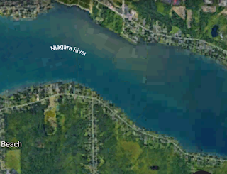
Image from Google Earth
This narrowing of the Tonawanda Channel of the Upper Niagara River, as water flows from right to left, is what I call the Wheatfield Valve.
The result was a surge island which actually lies just below the water level and is not shown on conventional maps but which can be seen in the satellite images and sprouts a large area of reeds in warm weather which can be easily seen from the trail leading to Wood's Creek. The great difference between this island and the other surge and vector islands that we have discussed is that the channel between the island and the mainland of Grand Island is so wide and the island is small.
This was caused by the curve of land discussed above throwing water at an almost parallel section of land on northern Grand Island. The elongated crescent-shaped inlet in which the island is located is, however, clearly visible on maps. Since this does not, as far as I know, have a name, let's christen it "Surge Inlet and Surge Island".

Image from Google Earth
You may notice that Wood's Creek empties into the river behind Surge Island. The reason that I am not calling it a vector island is simply that the mouth of Wood's Creek is downstream almost at the western end of Surge Inlet and so, I do not think it was a factor in the island's formation at all. Besides, the channel separating the island from the mainland of Grand Island is very large in comparison with the output from Wood's Creek.
We also see another elongated crescent-shaped inlet resembling surge Inlet. This one is on the south shore of the western arm of Cayuga Island across the river from Surge Inlet. It was clearly carved by surges of water diverted by the curve of land before the narrowing of the river at Stony Point Road opposite the curve of land on the opposite shore where Sunset Drive and Hird Street is located.
Looking on a map, we can see how this is the logical place for the surge flow diverted by the curve of land before the narrowing to meet land. But the Cayuga Island inlet at Griffon Park was eroded by surge flows from the same place. The reason that a small surge island was not carved out of this western arm of Cayuga Island, there is only the shallow elongated crescent inlet, is that the surge flow was meeting the land at such a shallow angle. Remember that surge islands usually form when the surge line meets land at from 45 to 90 degrees.
Let's call this inlet carved into Cayuga Island "West Rivershore Inlet" after the nearby street of that name. Both Surge Inlet and West Rivershore Inlet are clearly visible from the northbound North Grand Island Bridge.

Image from Google Earth
The following image is the surge line, the main thrust of the surge of water from the Wheatfield Valve from right to left, that formed Surge Inlet and Surge Island.

The following image is of the surge line, from the Wheatfield Valve, that formed the West Rivershore Inlet.

Image from Google Earth
Since these two opposite curves of land before the narrowing focuses surge flows somewhat like a spray valve, except to the outsides of the river downstream instead of to a focal point, why not name it "The Wheatfield Valve"?
These criss-crossing flows of water shows that what we are really dealing with here is a kind of a cross between a river and the lake it once was. The entire portion of the Niagara River flowing east-west, from North Tonawanda down to the falls, is essentially the remnants of Lake Tonawanda adapted to the river. The portions of the river which flow north-south is the real "river".
Almost all of the attention to the Niagara River, with regard to natural history, goes to the falls and the gorge of the lower river. But I think it is the islands of the upper river that are really unique.
No comments:
Post a Comment